Tocht Stappen Val de Bagnes - Mont-Brûlé - Photo
 verbier
verbier

Gebruiker

© OpenStreetMap contributors
Lengte
Lengte
16,9 km
Max. hoogte
Max. hoogte
2552 m
Positief hoogteverschil
1108 m
Km-Effort
Km-Effort  
32 km
Min. hoogte
Min. hoogte
1543 m
Negatief hoogteverschil
1108 m
Boucle
Boucle
Ja
Datum van aanmaak :
2014-12-10 00:00:00.0
Laatste wijziging :
2014-12-10 00:00:00.0

(0 Bericht)

Stappen
Stappen
5h24
Moeilijkheid : Onbekend

Scan deze QR-code om de tocht te openen in de SityTrail-applicatie

Gratisgps-wandelapplicatie

Logo SityTrail SityTrail

IGN / Geografische instituten

SityTrail uit de App Store downloaden SityTrail uit Google Play downloaden

Logo SityTrail SityTrail World

De wereld gaat voor u open

SityTrail uit de App Store downloaden SityTrail uit Google Play downloaden SityTrail op Huawei AppGallery downloaden

Over ons

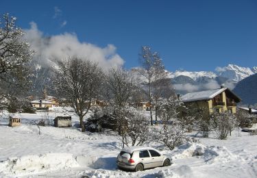
Tocht Stappen van 16,9 km beschikbaar op Valais/Wallis, Entremont, Val de Bagnes. Deze tocht wordt voorgesteld door verbier.

Beschrijving

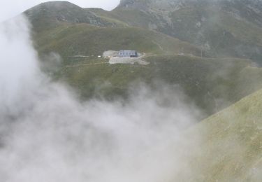
La randonnée débute à La Côt et se poursuit en passant par le Tseppiet  et les Ecuries de Mille où vous pourrez admirer les célèbres vaches de la race d''Hérens. Ensuite, continuez votre montée jusqu''au Mont-Brûlé et faites un petit détour par la cabane de Mille. Puis longez l''arête jusqu''au Larzey où la vue est magnifique sur l''Entremont. Finissez votre randonnée en empruntant un sentier facile qui vous emmènera jusqu''à La Côt.

Hoogteprofiel

POI's

POI Sembrancher -  - Photo
verbier
SEMBRANCHER 
POI Liddes - Mont-Brûlé - Photo
verbier
LIDDES 
POI Liddes - Cabane de Mille - Photo
verbier

Plaatsbepaling

Land:
Switzerland
Regio :
Valais/Wallis
Departement/Provincie :
Entremont
Gemeente :
Val de Bagnes
Locatie:
Unknown
Vertrek:(Dec)
Vertrek:(UTM)
360772 ; 5102555 (32T) N.

Wandeltochten in de omgeving

Tocht Te voet Val de Bagnes - Vollèges - Levron - Photo
Te voet
PRO

Te voet

Gemakkelijk
Val de Bagnes, Valais/Wallis, Entremont, Switzerland
3,3 km | 7,8 km-effort
1h 46min
Neen
Tocht Te voet Val de Bagnes - Vollèges - Levron - Photo
Te voet
PRO

Te voet

Gemakkelijk
Val de Bagnes, Valais/Wallis, Entremont, Switzerland
5,4 km | 10,3 km-effort
2h 20min
Neen
Tocht Te voet Orsières - Chemins pédestre, commune d'Orsières - Photo
Te voet
PRO

Te voet

Gemakkelijk
Orsières, Valais/Wallis, Entremont, Switzerland
5,4 km | 14,1 km-effort
3h 12min
Neen
Tocht Stappen Val de Bagnes - Le Châble – Cabane de Louvie / Jour 2 - Photo
Stappen
Greg813

Stappen

Moeilijk
Val de Bagnes, Valais/Wallis, Entremont, Switzerland
12,4 km | 21 km-effort
3h 37min
Neen
Tocht Te voet Val de Bagnes - Promenade de la Dranse - Photo
Te voet
PRO

Te voet

Gemakkelijk
Val de Bagnes, Valais/Wallis, Entremont, Switzerland
7,1 km | 9,4 km-effort
2h 8min
Neen
Tocht Te voet Val de Bagnes - Chemins pédestres, région Bagnes - Photo
Te voet
PRO

Te voet

Gemakkelijk
Val de Bagnes, Valais/Wallis, Entremont, Switzerland
6,2 km | 15 km-effort
3h 24min
Neen
Tocht Te voet Val de Bagnes - Bruson - Moay - Photo
Te voet
PRO

Te voet

Gemakkelijk
Val de Bagnes, Valais/Wallis, Entremont, Switzerland
3,6 km | 10 km-effort
2h 16min
Neen
Tocht Te voet Val de Bagnes - LaboNature Entremont - Photo
Te voet
PRO

Te voet

Gemakkelijk
Val de Bagnes, Valais/Wallis, Entremont, Switzerland
3,5 km | 5,1 km-effort
1h 8min
Ja
Tocht Te voet Sembrancher - Chemins pédestre, commune de Sembrancher - Photo
Te voet
PRO

Te voet

Gemakkelijk
Sembrancher, Valais/Wallis, Entremont, Switzerland
4,9 km | 11,3 km-effort
2h 34min
Neen


Sluiten
Mijn abonnementen